![](/images/other/stat-length.png)
![Randonnée V.T.T. La Bruffière - Circuit des étangs - court - La Bruffière - Photo](https://media.geolcdn.com/t/1900/400/ext.pjpeg?maxdim=2&url=https%3A%2F%2Fservices.sitytrail.com%2FGeolivesWS%2FDownloadMedia.ashx%3FTrailID%3D317511%26Media%3D16750_4.jpg)
Circuit des étangs - court - La Bruffière
tracegps
Utilisateur
![Longueur](/images/other/stat-length.png)
Longueur
14,6 km
![Altitude max](https://static1.geolcdn.com/siteimages/upload/files/1508320355ic_sort_altitude_max_24dp.png)
Altitude max
83 m
![Dénivelé positif](https://static1.geolcdn.com/siteimages/upload/files/1508320355ic_sort_den_pos_24dp.png)
Dénivelé positif
93 m
![Km-Effort](/images/other/stat-length.png)
Km-Effort
15,8 km
![Altitude min](https://static1.geolcdn.com/siteimages/upload/files/1508320355ic_sort_altitude_min_24dp.png)
Altitude min
54 m
![Dénivelé négatif](https://static1.geolcdn.com/siteimages/upload/files/1508320355ic_sort_den_neg_24dp.png)
Dénivelé négatif
91 m
![Boucle](https://static1.geolcdn.com/siteimages/upload/files/16400158638029165_repeat_loop_refresh_sync_direction_icon.png)
Boucle
Oui
Date de création :
2014-12-10 00:00:00.0
Dernière modification :
2014-12-10 00:00:00.0
![V.T.T.](https://static1.geolcdn.com/sitytour/trail-icons/202.png)
1h19
Difficulté : Facile
![Scannez ce code QR pour ouvrir la randonnée dans l'application SityTrail](https://capi.geolives.com/qq0zvz2zws4bq2lad0pu/sitytour/trails/317511/qr.png?size=200)
Application GPS de randonnée GRATUITE
À propos
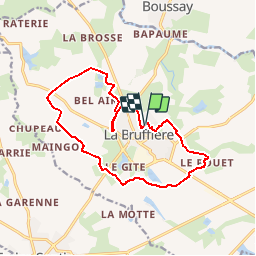
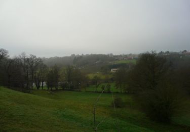
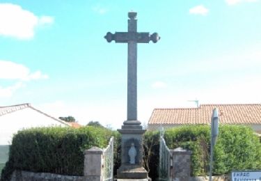
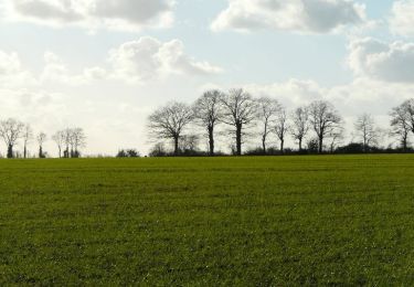
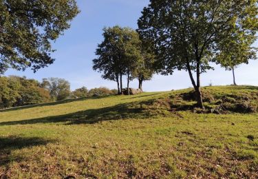
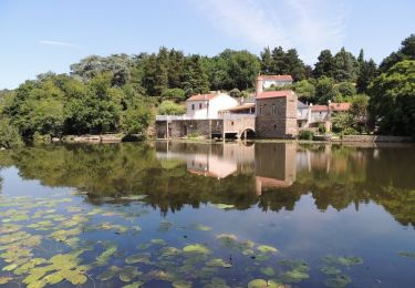
Randonnée V.T.T. de 14,6 km à découvrir à Pays de la Loire, Vendée, La Bruffière. Cette randonnée est proposée par tracegps.
Description
Départ du stade, rue du Stade. Le circuit emprunte de nombreux chemins de remembrement et de section de routes, soyez vigilants aux abords des CD 77 et 753. Retrouvez le circuit sur le site de la commune de La Bruffière.
Localisation
Pays :
France
Région :
Pays de la Loire
Département/Province :
Vendée
Commune :
La Bruffière
Localité :
Unknown
Départ:(Dec)
Départ:(UTM)
637252 ; 5208520 (30T) N.
Commentaires
Randonnées à proximité
![Randonnée A pied Boussay - Les Rochers - Photo](https://media.geolcdn.com/t/375/260/ext.jpg?maxdim=2&url=https%3A%2F%2Fmedia.geolcdn.com%2Ff%2F3ecea909-2cb0-40d7-a89a-0b1bd73102e1.jpeg)
![A pied A pied](https://static1.geolcdn.com/sitytour/trail-icons/100.png)
Les Rochers
A pied
Facile
Boussay,
Pays de la Loire,
Loire-Atlantique,
France
![](/images/other/stat-length.png)
12,1 km | 13,8 km-effort
3h 7min
![](https://static1.geolcdn.com/siteimages/upload/files/16400158638029165_repeat_loop_refresh_sync_direction_icon.png)
Oui
![Randonnée Marche Cugand - Hucheloup Hu - Photo](https://media.geolcdn.com/t/375/260/ext.jpg?maxdim=2&url=https%3A%2F%2Fmedia.geolcdn.com%2Ff%2F28b218cd-cc11-4b98-988e-6a2eaaaf2ccc.jpg)
![Marche Marche](https://static1.geolcdn.com/sitytour/trail-icons/101.png)
![Randonnée Marche Cugand - Hucheloup - Photo](https://media.geolcdn.com/t/375/260/ext.jpg?maxdim=2&url=https%3A%2F%2Fmedia.geolcdn.com%2Ff%2F6d1dbebb-a4ed-4e46-ab55-94ff3fc1f0e2.jpg)
![Marche Marche](https://static1.geolcdn.com/sitytour/trail-icons/101.png)
![Randonnée Marche La Bruffière - boucle Boussay Hucheloup - Photo](https://media.geolcdn.com/t/375/260/ext.jpg?maxdim=2&url=https%3A%2F%2Fmedia.geolcdn.com%2Ff%2Fea114df9-7e90-42f6-b74a-1bf920b6e24a.jpg)
![Marche Marche](https://static1.geolcdn.com/sitytour/trail-icons/101.png)
boucle Boussay Hucheloup
Marche
Moyen
La Bruffière,
Pays de la Loire,
Vendée,
France
![](/images/other/stat-length.png)
17,4 km | 21 km-effort
3h 59min
![](https://static1.geolcdn.com/siteimages/upload/files/16400158638029165_repeat_loop_refresh_sync_direction_icon.png)
Oui
![Randonnée V.T.T. La Bruffière - Circuit de la Sèvre Nantaise - La Bruffière - Photo](https://media.geolcdn.com/t/375/260/ext.jpg?maxdim=2&url=https%3A%2F%2Fservices.sitytrail.com%2FGeolivesWS%2FDownloadMedia.ashx%3FTrailID%3D317514%26Media%3D16753_6.jpg)
![V.T.T. V.T.T.](https://static1.geolcdn.com/sitytour/trail-icons/202.png)
Circuit de la Sèvre Nantaise - La Bruffière
V.T.T.
Moyen
La Bruffière,
Pays de la Loire,
Vendée,
France
![](/images/other/stat-length.png)
25 km | 29 km-effort
2h 0min
![](https://static1.geolcdn.com/siteimages/upload/files/16400158638029165_repeat_loop_refresh_sync_direction_icon.png)
Oui
![Randonnée V.T.T. La Bruffière - Circuit des hameaux - La Bruffière - Photo](https://media.geolcdn.com/t/375/260/ext.jpg?maxdim=2&url=https%3A%2F%2Fservices.sitytrail.com%2FGeolivesWS%2FDownloadMedia.ashx%3FTrailID%3D317513%26Media%3D16752_3.jpg)
![V.T.T. V.T.T.](https://static1.geolcdn.com/sitytour/trail-icons/202.png)
Circuit des hameaux - La Bruffière
V.T.T.
Moyen
La Bruffière,
Pays de la Loire,
Vendée,
France
![](/images/other/stat-length.png)
23 km | 25 km-effort
2h 0min
![](https://static1.geolcdn.com/siteimages/upload/files/16400158638029165_repeat_loop_refresh_sync_direction_icon.png)
Oui
![Randonnée V.T.T. La Bruffière - Circuit des étangs - long - La Bruffière - Photo](https://media.geolcdn.com/t/375/260/ext.jpg?maxdim=2&url=https%3A%2F%2Fservices.sitytrail.com%2FGeolivesWS%2FDownloadMedia.ashx%3FTrailID%3D317512%26Media%3D16751_3.jpg)
![V.T.T. V.T.T.](https://static1.geolcdn.com/sitytour/trail-icons/202.png)
Circuit des étangs - long - La Bruffière
V.T.T.
Moyen
La Bruffière,
Pays de la Loire,
Vendée,
France
![](/images/other/stat-length.png)
22 km | 23 km-effort
1h 49min
![](https://static1.geolcdn.com/siteimages/upload/files/16400158638029165_repeat_loop_refresh_sync_direction_icon.png)
Oui
![Randonnée Marche La Bruffière - Circuit des châtelaines - La Bruffière - Photo](https://media.geolcdn.com/t/375/260/ext.jpg?maxdim=2&url=https%3A%2F%2Fservices.sitytrail.com%2FGeolivesWS%2FDownloadMedia.ashx%3FTrailID%3D317510%26Media%3D16749_6.jpg)
![Marche Marche](https://static1.geolcdn.com/sitytour/trail-icons/101.png)
Circuit des châtelaines - La Bruffière
Marche
Difficile
La Bruffière,
Pays de la Loire,
Vendée,
France
![](/images/other/stat-length.png)
15 km | 17,2 km-effort
3h 45min
![](https://static1.geolcdn.com/siteimages/upload/files/16400158638029165_repeat_loop_refresh_sync_direction_icon.png)
Oui
![Randonnée Marche La Bruffière - Circuit de l'étang Beau Soleil - La Bruffière - Photo](https://media.geolcdn.com/t/375/260/ext.jpg?maxdim=2&url=https%3A%2F%2Fservices.sitytrail.com%2FGeolivesWS%2FDownloadMedia.ashx%3FTrailID%3D317509%26Media%3D16748_6.jpg)
![Marche Marche](https://static1.geolcdn.com/sitytour/trail-icons/101.png)
Circuit de l'étang Beau Soleil - La Bruffière
Marche
Moyen
La Bruffière,
Pays de la Loire,
Vendée,
France
![](/images/other/stat-length.png)
10,9 km | 12,1 km-effort
2h 45min
![](https://static1.geolcdn.com/siteimages/upload/files/16400158638029165_repeat_loop_refresh_sync_direction_icon.png)
Oui